Schoolyard Spring Preserve: From main crossroad, go north on Hwy 133 for 0.2 mile and turn left on Long Road, continue 0.1 mile and park on left at sign for preserve. This is next to the elementary school.
Lat-Long: 36.523618,-81.925468
Appalachian Trail access: From main crossroad, go south on Hwy 91 for 3.7 miles to parking lot on left for trail on crest of Cross Mountain at the Johnson / Carter County line.. Another access point can be reached by going north on Hwy 421 for 2.8 miles to Low Gap on Holston Mountain at the Johnson / Sullivan County line.
Cherokee National Forest: All roads leading into Shady Valley pass through National Forest lands. Hwy 421 crosses Holston Mountain, with a few pull-offs available along the hwy, then continues over Iron Mountain en route to Mountain City. Hwy 91 goes over Cross Mountain, but offers few stopping points until you reach the Appalachian Trail crossing on top. On Hwy 133, at 3.0 miles north of the main crossroad is McQueen Gap Road on left. Continuing north on Hwy 133 are several pull-offs once you reach the forested area, as well as parking at Backbone Rock and a campground / picnic area just beyond.
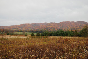
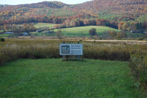
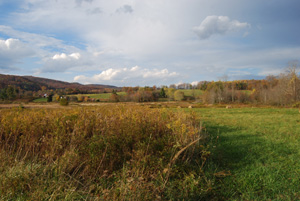
Site Description: Shady Valley is a high bowl-shaped valley (elevation ~ 2800 ft.) surrounded on three sides by higher ridges: Holston, Iron, and Cross Mountains (elevation ~ 3400-4200 ft). Beaverdam Creek, which drains the valley, flows northward into Virginia; the last few miles tumble through a forested gorge. The valley floor once held large cranberry bogs and spruce-hemlock forests. Today most of this area consists of small farms, woodlots, and home sites with a pleasant rural feel. Two stores and a small restaurant sit at the main crossroad.
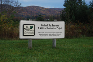
The Nature Conservancy owns several tracts in Shady Valley which provide excellent birding opportunities. The best of these are the Orchard Bog, Quarry Bog, and Schoolyard Springs preserves. The two bogs consist of large fields and wetland restoration areas. Mowed walking paths provide access to marsh edges. Schoolyard Springs is a smaller, more wooded tract with a short boardwalk and walking path. The Jenkins Cranberry Bog is a tiny remnant of a bygone era.
Several side roads in the valley offer good roadside birding. Examples are Orchard Road, Winchester Road, and Gentry Road / Sluder Road. Please do not trespass on private property.
The Cherokee National Forest provides low to mid-elevation woodland birding. Pull-offs on Hwy 133 are beside lower Beaverdam Creek and geology alone justifies a stop at Backbone Rock. Roadside pull-offs on Hwy 421 and the Appalachian Trail provide access to the mountain tops and mid-slopes.
Wildlife to Watch: On the valley floor, thickets along streams have nesting Willow Flycatcher, Yellow Warbler, Common Yellowthroat, and Gray Catbird. Grassy fields may have nesting Grasshopper, Savannah, or Vesper Sparrows. Yards and field edges host nesting Eastern Bluebird, Chipping and Song Sparrows, House Wren, and Tree Swallow. Virginia Rail may be found in Quarry or Orchard Bog year-round, although spring is best. Woodcock call and display at dusk (February - March) at these two sites, also. Migration season brings other warblers, sparrows, etc.; American Bittern, Sora and Northern Harrier are possible in bogs at that season. Wood Ducks occur on ponds and Beaverdam Creek. Wild Turkeys are found throughout. Common Ravens may fly over at any season. Whip-poor-wills and owls may be heard calling at night from adjacent ridges.
Forested areas along lower Beaverdam Creek have nesting warblers, vireos, Wood Thrush, Scarlet Tanager, etc. Black-throated Blue, Black-throated Green, and Hooded Warblers, Ovenbird, Northern Parula, and Louisiana Waterthrush are common. A few Swainson's Warblers occur in rhododendron thickets along the creek (May - June is best). The cool wet gorge often has a few species normally found at higher elevations: Canada Warbler, Winter Wren, Dark-eyed Junco.
Many of these same species are found on the mountain slopes. Dark-eyed Junco and Canada Warbler become more numerous near the mountain tops. Yellow-bellied Sapsucker, Veery, and Blackburnian Warbler are possible at the higher elevations. Ruffed Grouse occur, but are usually just chanced upon.
Beavers occupy several wetland sites, but are seldom seen. Instead, look for their dams and lodges.
Submit your data to eBird and help us add to the list of birds seen at this site
Information for this site page was generously contributed by Rick Knight.